
Mauritania Population: 3,840,429
10 VISITORS FROM HERE!«  Previous Country | Next Country Previous Country | Next Country  » Back to Flag Counter Overview » Back to Flag Counter Overview | 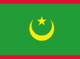 |
| History | |
| Independent from France in 1960, Mauritania annexed the southern third of the former Spanish Sahara (now Western Sahara) in 1976 but relinquished it after three years of raids by the Polisario guerrilla front seeking independence for the territory. Maaouya Ould Sid Ahmed TAYA seized power in a coup in 1984 and ruled Mauritania with a heavy hand for more than two decades. A series of presidential elections that he held were widely seen as flawed. A bloodless coup in August 2005 deposed President TAYA and ushered in a military council that oversaw a transition to democratic rule. Independent candidate Sidi Ould Cheikh ABDALLAHI was inaugurated in April 2007 as Mauritania's first freely and fairly elected president. His term ended prematurely in August 2008 when a military junta led by General Mohamed Ould Abdel AZIZ deposed him and installed a military council government. AZIZ was subsequently elected president in July 2009 and sworn in the following month. AZIZ sustained injuries from an accidental shooting by his own troops in October 2012 but has continued to maintain his authority. He was reelected in 2014 to a second and final term as president (according to the present constitution). AZIZ will be replaced through elections scheduled for June 2019. The country continues to experience ethnic tensions among three major groups: Arabic-speaking descendants of slaves (Haratines), Arabic-speaking "White Moors" (Beydane), and members of Sub-Saharan ethnic groups mostly originating in the Senegal River valley (Halpulaar, Soninke, and Wolof). Al-Qaeda in the Islamic Maghreb (AQIM) launched a series of attacks in Mauritania between 2005 and 2011, murdering American and foreign tourists and aid workers, attacking diplomatic and government facilities, and ambushing Mauritanian soldiers and gendarmes. A successful strategy against terrorism that combines dialogue with the terrorists and military actions has prevented the country from further terrorist attacks since 2011. However, AQIM and similar groups remain active in neighboring Mali and elsewhere in the Sahel region and continue to pose a threat to Mauritanians and foreign visitors. |

|  |
| Geography | |
| |
| Location: | Western Africa, bordering the North Atlantic Ocean, between Senegal and Western Sahara |
| Geographic coordinates: | 20 00 N, 12 00 W |
| Area: | total: 1,030,700 sq km land: 1,030,700 sq km water: 0 sq km Size comparison: slightly larger than three times the size of New Mexico; about six times the size of Florida |
| Land Boundaries: | total: 5,002 km border countries (4): Algeria 460 km, Mali 2236 km, Senegal 742 km, Western Sahara 1564 km |
| Coastline: | 754 km |
| Maritime claims: | territorial sea: 12 nm exclusive economic zone: 200 nm contiguous zone: 24 nm continental shelf: 200 nm or to the edge of the continental margin |
| Climate: | desert; constantly hot, dry, dusty |
| Terrain: | mostly barren, flat plains of the Sahara; some central hills |
| Natural resources: | iron ore, gypsum, copper, phosphate, diamonds, gold, oil, fish |
| Land use: | agricultural land: 38.5% (2011 est.) arable land: 0.4% (2011 est.) permanent crops: 0% (2011 est.) permanent pasture: 38.1% (2011 est.) forest: 0.2% (2011 est.) other: 61.3% (2011 est.) |
| Irrigated land: | 450 sq km (2012) |
| Natural hazards: | hot, dry, dust/sand-laden sirocco wind primarily in March and April; periodic droughts |
| Current Environment Issues: | overgrazing, deforestation, and soil erosion aggravated by drought are contributing to desertification; limited natural freshwater resources away from the Senegal, which is the only perennial river; locust infestation |
| International Environment Agreements: | party to: Biodiversity, Climate Change, Climate Change-Kyoto Protocol, Desertification, Endangered Species, Hazardous Wastes, Law of the Sea, Ozone Layer Protection, Ship Pollution, Wetlands, Whaling signed, but not ratified: none of the selected agreements |
| ^Back to Top | |
| People | |
| Nationality: | noun: Mauritanian(s) adjective: Mauritanian |
| Ethnic groups: | black Moors (Haratines - Arab-speaking slaves, former slaves, and their descendants of African origin, enslaved by white Moors) 40%, white Moors (of Arab-Berber descent, known as Beydane) 30%, sub-Saharan Mauritanians (non-Arabic speaking, largely resident in or originating from the Senegal River Valley, including Halpulaar, Fulani, Soninke, Wolof, and Bambara ethnic groups) 30% |
| Languages: | Arabic (official and national), Pular, Soninke, Wolof (all national languages), French note: the spoken Arabic in Mauritania differs considerably from the modern standard Arabic used for official written purposes or in the media; the Mauritanian dialect, which incorporates many Berber words, is referred to as Hassaniya |
| Religions: | Muslim (official) 100% |
| Population: | 3,840,429 (July 2018 est.) |
| Age structure: | 0-14 years: 38.24% (male 737,570 /female 730,969) 15-24 years: 19.78% (male 372,070 /female 387,375) 25-54 years: 33.44% (male 595,472 /female 688,620) 55-64 years: 4.74% (male 82,197 /female 99,734) 65 years and over: 3.81% (male 62,072 /female 84,350) (2018 est.) |
| Dependency ratios: | total dependency ratio: 76.5 (2015 est.) youth dependency ratio: 71 (2015 est.) elderly dependency ratio: 5.5 (2015 est.) potential support ratio: 18.3 (2015 est.) |
| Median age: | total: 20.7 years male: 19.7 years female: 21.6 years (2018 est.) |
| Population growth rate: | 2.14% (2018 est.) |
| Birth rate: | 29.9 births/1,000 population (2018 est.) |
| Death rate: | 7.8 deaths/1,000 population (2018 est.) |
| Net migration rate: | -0.8 migrant(s)/1,000 population (2018 est.) |
| Urbanization: | urban population: 53.7% of total population (2018) rate of urbanization: 4.28% annual rate of change (2015-20 est.) |
| Major urban areas - population: | 1.205 million NOUAKCHOTT (capital) (2018) |
| Sex ratio: | at birth: 1.03 male(s)/female 0-14 years: 1.01 male(s)/female 15-24 years: 0.96 male(s)/female 25-54 years: 0.86 male(s)/female 55-64 years: 0.82 male(s)/female 65 years and over: 0.74 male(s)/female total population: 0.93 male(s)/female (2018 est.) |
| Maternal mortality rate: | 602 deaths/100,000 live births (2015 est.) |
| Infant mortality rate: | total: 50.5 deaths/1,000 live births male: 55.3 deaths/1,000 live births female: 45.6 deaths/1,000 live births (2018 est.) |
| Life expectancy at birth: | total population: 63.8 years male: 61.4 years female: 66.2 years (2018 est.) |
| Total fertility rate: | 3.79 children born/woman (2018 est.) |
| Contraceptive prevalence rate: | 17.8% (2015) |
| Physicians density: | 0.18 physicians/1,000 population (2017) |
| Drinking water source: | improved: urban: 58.4% of population rural: 57.1% of population total: 57.9% of population unimproved: urban: 41.6% of population rural: 42.9% of population total: 42.1% of population (2015 est.) |
| Sanitation facility access: | improved: urban: 57.5% of population (2015 est.) rural: 13.8% of population (2015 est.) total: 40% of population (2015 est.) unimproved: urban: 42.5% of population (2015 est.) rural: 86.2% of population (2015 est.) total: 60% of population (2015 est.) |
| HIV/AIDS - adult prevalence rate: | 0.3% (2017 est.) |
| HIV/AIDS - people living with HIV/AIDS: | 9,000 (2017 est.) |
| HIV/AIDS - deaths: | <1000 (2017 est.) |
| Obesity - adult prevalence rate: | 12.7% (2016) |
| Children under the age of 5 years underweight: | 24.9% (2015) |
| Education expenditures: | 2.6% of GDP (2016) |
| Literacy: | definition: age 15 and over can read and write (2015 est.) total population: 52.1% male: 62.6% female: 41.6% (2015 est.) |
| School life expectancy (primary to tertiary education): | total: 8 years male: 8 years female: 8 years (2017) Unemployment, youth ages 15-24: total: 15.2% male: 14.1% female: 17% (2012 est.) |
| ^Back to Top | |
| Government | |
| Country name: | conventional long form: Islamic Republic of Mauritania conventional short form: Mauritania local long form: Al Jumhuriyah al Islamiyah al Muritaniyah local short form: Muritaniyah etymology: named for the ancient kingdom of Mauretania (3rd century B.C. to 1st century A.D.), which existed further north in present-day Morocco; the name derives from the Mauri (Moors), the Berber-speaking peoples of northwest Africa |
| Government type: | presidential republic |
| Capital: | name: Nouakchott geographic coordinates: 18 04 N, 15 58 W time difference: UTC 0 (5 hours ahead of Washington, DC, during Standard Time) etymology: may derive from the Berber "nawakshut" meaning "place of the winds" |
| Administrative divisions: | 15 regions (wilayas, singular - wilaya); Adrar, Assaba, Brakna, Dakhlet Nouadhibou, Gorgol, Guidimaka, Hodh ech Chargui, Hodh El Gharbi, Inchiri, Nouakchott Nord, Nouakchott Ouest, Nouakchott Sud, Tagant, Tiris Zemmour, Trarza |
| Independence: | 28 November 1960 (from France) |
| National holiday: | Independence Day, 28 November (1960) |
| Constitution: | history: previous 1964; latest adopted 12 July 1991 amendments: proposed by the president of the republic or by Parliament; consideration of amendments by Parliament requires approval of at least one-third of the membership; a referendum is held only if the amendment is approved by two-thirds majority vote; passage by referendum requires simple majority vote by eligible voters; passage of amendments proposed by the president can bypass a referendum if approved by at least three-fifths majority vote by Parliament; amended many times, last in 2017 (by referendum) (2019) |
| Legal system: | mixed legal system of Islamic and French civil law |
| Suffrage: | 18 years of age; universal |
| Executive branch: | chief of state: President Mohamed Cheikh El GHAZOUANI (since 1 August 2019) head of government: Prime Minister Mohamed Salem Ould BECHIR (since 29 October 2018) cabinet: Council of Ministers - nominees suggested by the prime minister, appointed by the president elections/appointments: president directly elected by absolute majority popular vote in 2 rounds if needed for a 5-year term (eligible for a second term); election last held on 22 June 2019 (next scheduled for 22 June 2024); prime minister appointed by the president election results: Mohamed Cheikh El GHAZOUANI elected president in first round; percent of vote - Mahamed Cheikh El GHAZOUANI (UPR) 52%, Biram Dah Ould ABEID (independent) 18.6%, Sidi Mohamed Ould BOUBACAR (independent) 17.9%, other 11.55% |
| Legislative branch: | description: unicameral Parliament or Barlamane consists of the National Assembly or Al Jamiya Al Wataniya (157 seats; 113 members in single- and multi-seat constituencies directly elected by a combination of plurality and proportional representation voting systems, 40 members in a single, nationwide constituency directly elected by proportional representation vote, and 4 members directly elected by the diaspora; all members serve 5-year terms) elections: first held as the unicameral National Assembly in 2 rounds on 1 and 15 September 2018 (next to be held in 2023) election results: National Assembly - percent of vote by party - NA; seats by party - NA; composition - NA note: a referendum held in August 2017 approved a constitutional amendment to change the Parliament structure from bicameral to unicameral by abolishing the Senate and creating Regional Councils for local development |
| Judicial branch: | highest courts: Supreme Court or Cour Supreme (subdivided into 1 criminal and 2 civil chambers, each with a president and 5 counselors); Constitutional Council (consists of 6 members) judge selection and term of office: Supreme Court president appointed by the president of the republic to serve a 5-year renewable term; Constitutional Council members appointed - 3 by the president of the republic, 2 by the president of the National Assembly, and 1 by the president of the Senate; members serve single, 9-year terms with one-third of membership renewed every 3 years subordinate courts: High Court of Justice (cases involving treason and criminal acts of high government officials, including the president); courts of appeal; wilaya (regional) courts; commercial and labor courts; criminal courts; moughataa (district) courts; informal/customary courts |
| Political parties and leaders: | Alliance for Justice and Democracy/Movement for Renewal or AJD/MR [Ibrahima Moctar SARR] Burst of Youth for the Nation [Lalla Mint CHERIF] Coalition of Majority Parties or CPM (includes UPR, UDP) El Karama Party [Cheikhna Ould Mohamed Ould HAJBOU] El Vadila Party [Ethmane Ould Ahmed ABOULMAALY] National Forum for Democracy and Unity or FNDU [Mohamed Ould MAOLOUD] (coalition of hard-line opposition parties, includes RNRD-TAWASSOUL) National Rally for Reform and Development or RNRD-TAWASSOUL [Mohamed Mahmoud Ould SEYIDI] Party of Unity and Development or PUD [Mohamed BARO] Popular Progressive Alliance or APP [Messaoud Ould BOULKHEIR] Rally of Democratic Forces or RFD [Ahmed Ould DADDAH] Ravah Party [ Mohamed Ould VALL] Republican Party for Democracy and Renewal or PRDR [Mintata Mint HEDEID] Union for Democracy and Progress or UDP [Naha Mint MOUKNASS] Union of Progress Forces [Mohamed Ould MAOULOUD] Union for the Republic or UPR [Seyidna Ali Ould MOHAMED KHOUNA] |
| International organization participation: | ABEDA, ACP, AfDB, AFESD, AMF, AMU, AU, CAEU (candidate), EITI (compliant country), FAO, G-77, IAEA, IBRD, ICAO, ICC (NGOs), ICRM, IDA, IDB, IFAD, IFC, IFRCS, IHO (pending member), ILO, IMF, IMO, Interpol, IOC, IOM, IPU, ISO (correspondent), ITSO, ITU, ITUC (NGOs), LAS, MIGA, MIUSMA, NAM, OIC, OIF, OPCW, UN, UNCTAD, UNESCO, UNIDO, UNWTO, UPU, WCO, WHO, WIPO, WMO, WTO |
| National symbol(s): | five-pointed star between the horns of a horizontal crescent moon; national colors: green, yellow |
| National anthem: | name: "Hymne National de la Republique Islamique de Mauritanie" (National Anthem of the Islamic Republic of Mauritania) lyrics/music: Baba Ould CHEIKH/traditional, arranged by Tolia NIKIPROWETZKY note: adopted 1960; the unique rhythm of the Mauritanian anthem makes it particularly challenging to sing; Mauritania in November 2017 adopted a new national anthem, "Bilada-l ubati-l hudati-l kiram" (The Country of Fatherhood is the Honorable Gift) composed by Rageh Daoud (sound file of the new anthem is forthcoming) |
| Diplomatic representation in the US: | chief of mission: Ambassador Mohamedoun DADDAH (since 27 June 2016) chancery: 2129 Leroy Place NW, Washington, DC 20008 telephone: [1] (202) 232-5700 through 5701 FAX: [1] (202) 319-2623 |
| Diplomatic representation from the US: | chief of mission: Ambassador Michael J. DODMAN (since 5 January 2018) embassy: Avenue Al Quds, Nouadhibou, Nouadhibou Road, Nouakchott, Mauritania mailing address: same as embassy address telephone: [222] 4525-2660 or [222] 2660-2663 FAX: [222] 4525-1592 |
| ^Back to Top | |
| Economy | |
Mauritania's economy is dominated by extractive industries (oil and mines), fisheries, livestock, agriculture, and services. Half the population still depends on farming and raising livestock, even though many nomads and subsistence farmers were forced into the cities by recurrent droughts in the 1970s, 1980s, 2000s, and 2017. Recently, GDP growth has been driven largely by foreign investment in the mining and oil sectors. Mauritania's extensive mineral resources include iron ore, gold, copper, gypsum, and phosphate rock, and exploration is ongoing for tantalum, uranium, crude oil, and natural gas. Extractive commodities make up about three-quarters of Mauritania's total exports, subjecting the economy to price swings in world commodity markets. Mining is also a growing source of government revenue, rising from 13% to 30% of total revenue from 2006 to 2014. The nation's coastal waters are among the richest fishing areas in the world, and fishing accounts for about 15% of budget revenues, 45% of foreign currency earnings. Mauritania processes a total of 1,800,000 tons of fish per year, but overexploitation by foreign and national fleets threaten the sustainability of this key source of revenue. The economy is highly sensitive to international food and extractive commodity prices. Other risks to Mauritania's economy include its recurring droughts, dependence on foreign aid and investment, and insecurity in neighboring Mali, as well as significant shortages of infrastructure, institutional capacity, and human capital. In December 2017, Mauritania and the IMF agreed to a three year agreement under the Extended Credit Facility to foster economic growth, maintain macroeconomic stability, and reduce poverty. Investment in agriculture and infrastructure are the largest components of the country’s public expenditures. | |
| GDP (purchasing power parity): | $17.28 billion (2017 est.) $16.7 billion (2016 est.) $16.4 billion (2015 est.) note: data are in 2017 dollars |
| GDP (official exchange rate): | $4.935 billion (2017 est.) |
| GDP - real growth rate: | 3.5% (2017 est.) 1.8% (2016 est.) 0.4% (2015 est.) |
| GDP - per capita (PPP): | $4,500 (2017 est.) $4,400 (2016 est.) $4,400 (2015 est.) note: data are in 2017 dollars |
| Gross national saving: | 24.2% of GDP (2017 est.) 24.8% of GDP (2016 est.) 19% of GDP (2015 est.) GDP - composition, by end use: household consumption: 64.9% (2017 est.) government consumption: 21.8% (2017 est.) investment in fixed capital: 56.1% (2017 est.) investment in inventories: -3.2% (2017 est.) exports of goods and services: 39% (2017 est.) imports of goods and services: -78.6% (2017 est.) GDP - composition, by sector of origin: agriculture: 27.8% (2017 est.) industry: 29.3% (2017 est.) services: 42.9% (2017 est.) |
| Agriculture - products: | dates, millet, sorghum, rice, corn; cattle, camel and sheep |
| Industries: | fish processing, oil production, mining (iron ore, gold, copper) note: gypsum deposits have never been exploited |
| Industrial production growth rate: | 1% (2017 est.) |
| Labor force: | 1.437 million (2017 est.) |
| Labor force - by occupation: | agriculture: 50% industry: 1.9% services: 48.1% (2014 est.) |
| Unemployment rate: | 10.2% (2017 est.) 10.1% (2016 est.) |
| Population below poverty line: | 31% (2014 est.) |
| Household income or consumption by percentage share: | lowest 10%: 2.5% highest 10%: 29.5% (2000) |
| Distribution of family income - Gini index: | 37 (2014) 39 (2006 est.) |
| Budget: | revenues: 1.354 billion (2017 est.) expenditures: 1.396 billion (2017 est.) |
| Taxes and other revenues: | 27.4% (of GDP) (2017 est.) Budget surplus (+) or deficit (-): -0.8% (of GDP) (2017 est.) |
| Public debt: | 96.6% of GDP (2017 est.) 100% of GDP (2016 est.) |
| Fiscal year: | calendar year |
| Inflation rate (consumer prices): | 2.3% (2017 est.) 1.5% (2016 est.) |
| Current account balance: | -$711 million (2017 est.) -$707 million (2016 est.) |
| Exports: | $1.722 billion (2017 est.) $1.401 billion (2016 est.) |
| Exports - commodities: | iron ore, fish and fish products, livestock, gold, copper, crude oil |
| Exports - partners: | China 31.2%, Switzerland 14.4%, Spain 10.1%, Germany 8.2%, Japan 8.1% (2017) |
| Imports: | $2.094 billion (2017 est.) $1.9 billion (2016 est.) |
| Imports - commodities: | machinery and equipment, petroleum products, capital goods, foodstuffs, consumer goods |
| Imports - partners: | Belgium 11.5%, UAE 11.3%, US 9.2%, China 7.5%, France 7.4%, Netherlands 6.1%, Morocco 6%, Slovenia 4.8%, Vanuatu 4.7%, Spain 4.7% (2017) |
| Reserves of foreign exchange and gold: | $875 million (31 December 2017 est.) $849.3 million (31 December 2016 est.) |
| Debt - external: | $4.15 billion (31 December 2017 est.) $3.899 billion (31 December 2016 est.) |
| Stock of direct foreign investment - at home: | (31 December 2009 est.) |
| Market value of publicly traded shares: | n/a |
| Exchange rates: | ouguiyas (MRO) per US dollar - 363.6 (2017 est.) 352.37 (2016 est.) 352.37 (2015 est.) 319.7 (2014 est.) 299.5 (2013 est.) |
| ^Back to Top | |
| Energy | |
| Electricity - production: | 1.139 billion kWh (2016 est.) |
| Electricity - consumption: | 1.059 billion kWh (2016 est.) |
| Electricity - exports: | 0 kWh (2016 est.) |
| Electricity - imports: | 0 kWh (2016 est.) |
| Electricity - installed generating capacity: | 558,000 kW (2016 est.) |
| Electricity - from fossil fuels: | 65% of total installed capacity (2016 est.) |
| Electricity - from nuclear fuels: | 0% of total installed capacity (2017 est.) |
| Electricity - from hydroelectric plants: | 16% of total installed capacity (2017 est.) |
| Electricity - from other renewable sources: | 20% of total installed capacity (2017 est.) |
| Crude oil - production: | 4,000 bbl/day (2017 est.) |
| Crude oil - exports: | 5,333 bbl/day (2015 est.) |
| Crude oil - imports: | 0 bbl/day (2015 est.) |
| Crude oil - proved reserves: | 20 million bbl (1 January 2018 est.) |
| Refined petroleum products - production: | 0 bbl/day (2015 est.) |
| Refined petroleum products - consumption: | 17,000 bbl/day (2016 est.) |
| Refined petroleum products - exports: | 0 bbl/day (2015 est.) |
| Refined petroleum products - imports: | 17,290 bbl/day (2015 est.) |
| Natural gas - production: | 0 cu m (2017 est.) |
| Natural gas - consumption: | 0 cu m (2017 est.) |
| Natural gas - exports: | 0 cu m (2017 est.) |
| Natural gas - imports: | 0 cu m (2017 est.) |
| Natural gas - proved reserves: | 28.32 billion cu m (1 January 2018 est.) |
| Carbon dioxide emissions from consumption of energy: | 2.615 million Mt (2017 est.) |
| ^Back to Top | |
| Communications | |
| Cellular Phones in use: | total subscriptions: 4,074,157 subscriptions per 100 inhabitants: 108 (2017 est.) |
| Telephone system: | general assessment: limited system of cable and open-wire lines, minor microwave radio relay links, and radiotelephone communications stations; mobile-cellular services expanding rapidly; 3 mobile network operators; 3G penetration high; mobile broadband speeds are low; World Bank and European Investment Bank support attempts to improve telecom and improve regulatory measures; efforts to improve backbone of network; auction for fourth mobile provider and 4G service in spring 2019 (2018) domestic: fixed-line teledensity 2 per 100 persons; mobile-cellular network coverage extends mainly to urban areas with a teledensity of roughly 108 per 100 persons; mostly cable and open-wire lines; a domestic satellite telecommunications system links Nouakchott with regional capitals (2018) international: country code - 222; satellite earth stations - 3 (1 Intelsat - Atlantic Ocean, 2 Arabsat); fiber-optic and asymmetric digital subscriber line cables for Internet access |
| Broadcast media: | 10 TV stations: 5 government-owned and 5 private; in October 2017, the government suspended all private TV stations due to non-payment of broadcasting fees; as of April 2018, only one private TV station was broadcasting, Al Mourabitoune, the official TV of the Mauritanian Islamist party, Tewassoul; the other stations are negotiating payment options with the government and hope to be back on the air soon; 18 radio broadcasters: 15 government-owned, 3 (Radio Nouakchott Libre, Radio Tenwir, Radio Kobeni) private; all 3 private radio stations broadcast from Nouakchott; of the 15 government stations, 3 broadcast from Nouakchott (Radio Mauritanie, Radio Jeunesse, Radio Koran) and the other 12 broadcast from each of the 12 regions outside Nouakchott; Radio Jeunesse and Radio Koran are now also being re-broadcast in the regions (2019) |
| Internet country code: | .mr |
| Internet users: | total: 661,913 percent of population: 18% (July 2016 est.) |
| ^Back to Top | |
| Transportation | |
| Airports: | 30 (2013) |
| Airports (paved runways): | total 9 (2017) 2,438 to 3,047 m: 5 (2017) 1,524 to 2,437 m: 4 (2017) |
| Airports (unpaved runways): | total 21 (2013) 2,438 to 3,047 m: 1 (2013) 1,524 to 2,437 m: 10 (2013) 914 to 1,523 m: 8 (2013) under 914 m: 2 (2013) |
| Railways: | total 728 km (2014) standard gauge: 728 km 1.435-m gauge (2014) |
| Roadways: | total 12,253 km (2018) paved: 3,988 km (2018) unpaved: 8,265 km (2018) |
| Waterways: | (some navigation possible on the Senegal River) (2011) |
| Merchant marine: | total 7 by type: bulk carrier 1, general cargo 2, oil tanker 1, other 3 (2018) |
| Ports and terminals: | major seaport(s): Nouadhibou, Nouakchott |
| ^Back to Top | |
| Military | |
| Military branches: | Mauritanian Armed Forces: Army, Mauritanian Navy (Marine Mauritanienne; includes naval infantry), Islamic Republic of Mauritania Air Group (Groupement Aerienne Islamique de Mauritanie, GAIM) (2013) |
| Military service age and obligation: | 18 is the legal minimum age for voluntary military service; no conscription (2012) |
| Military expenditures: | 2.97% of GDP (2016) 2.75% of GDP (2015) 2.7% of GDP (2014) 2.56% of GDP (2013) 2.72% of GDP (2012) |
| ^Back to Top | |
| Transnational Issues | |
| Disputes - International: | Mauritanian claims to Western Sahara remain dormant |
| Refugees and internally displaced persons: | refugees (country of origin): 26,001 (Western Saharan Sahrawis) (2018); 56,923 (Mali) (2019) |
| ^Back to Top | |
«
Previous Country | Next Country » Back to Flag Counter OverviewSource: CIA - The World Factbook